Free Auvergnerhonealpes Videos
Auvergnerhonealpes videos and clips for free download in 4K & HD for your next video project.
Sorry, no clips were found! Browse
Sponsored by iStock
LIMITED DEAL: Save 20% on 4K Video from iStock


Location Auvergne-Rhone-Alpes on map France. 3d Auvergne-Rhone-Alpes flag map marker location pin. Map of France showing different parts. Animated map regions of France. 4K. Video

A valley dominated by forests, grassy meadows and green mountains towards Saint-Pierre-d'Entremont, in the Chartreuse massif, in the Alps, in Isère, in Auvergne-Rhône-Alpes, in France, in summer and by drone.
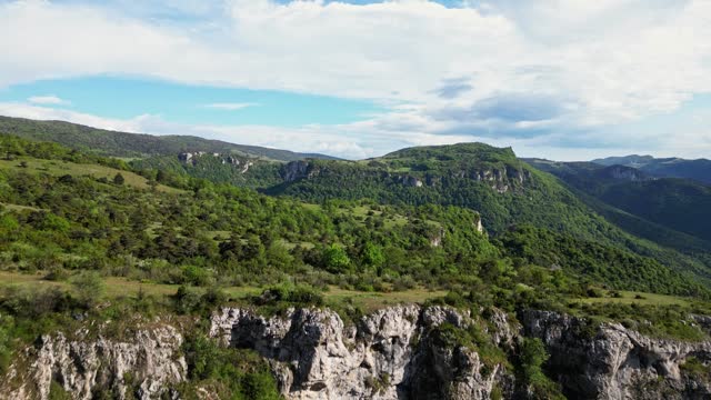
French countryside. Panoramic drone view of tree-covered hillsides of the heights of the Vercors, the marly hills and the valley Val de Drome, France
French countryside. Panoramic drone view of tree-covered hillsides of the heights of the Vercors, the marly hills and the valley Val de Drome, France

Panoramic drone view of The Grangent dam on the Loire river. Built between 1955 and 1957. Is located downstream of Aurec sur Loire in the surroundings of Saint-Etienne.


The green French countryside and its trees in Europe, France, Ardeche, in summer, on a sunny day.

drone shot revealing Saint Bonnet le Chateau collegiate church and village in Monts du Forez on an overcast day, Loire departement, France


Picturesque white mountain slopes covered with pine forests and skiing pistes and moving chairlift in evening Sunset aerial view. Alps


Aerial view of the winding road in the mountains. Aerial View Above Top view colorful Autumn Forest. Aerial Top View Over Straight Road With Cars in Colorful Countryside Autumn Forest.

The Mont de Gerbier de Jonc in Europe, in France, in Ardeche, in summer, during a sunny day.


The Mont de Gerbier de Jonc in its beautiful Ardèche countryside in Europe, in France, in Ardeche, in summer, during a sunny day.


Picturesque white mountain slopes covered with pine forests and skiing pistes and moving chairlift in evening Sunset aerial view. Alps


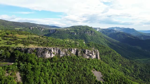
French countryside. Col de Rousset. Panoramic view of the heights of the Vercors, the marly hills and the valley Val de Drome, France

French countryside. Col de Rousset. Panoramic view of the heights of the Vercors, the marly hills and the valley Val de Drome, France

Picturesque white mountain slopes covered with pine forests and skiing pistes and moving chairlift in evening Sunset aerial view. Alps

Aerial view of dense historic center of Thiers town in Puy-de-Dome department, Auvergne-Rhone-Alpes region in France. Rooftops of old buildings and narrow streets


Drone footage of a person standing on the shore of Annecy lake spreading his arms at sunset, France

The river in the middle of the Gorges de l'Ardeche in Europe, France, in summer on a sunny day.

drone shot around saint bonnet le chateau collegiate church in the Monts du Forez near Saint Etienne, Loire departement, France

Aerial view of dense historic center of Thiers town in Puy-de-Dome department, Auvergne-Rhone-Alpes region in France. Rooftops of old buildings and narrow streets at sunset


French countryside. Col de Rousset. Panoramic view of the heights of the Vercors, the marly hills and the valley Val de Drome, France

French countryside. Col de Rousset. Panoramic view of the heights of the Vercors, the marly hills and the valley Val de Drome, France


Aerial view of dense historic center of Thiers town in Puy-de-Dome department, Auvergne-Rhone-Alpes region in France. Rooftops of old buildings and narrow streets at sunset


drone shot over Saint Bonnet le Chateau collegiate church revealing the Monts du Forez and the plaine du forez, loire departement near Saint Etienne, France


